R1a The
R1a lineage is believed to have originated in the Eurasian Steppes north of the
Black and

http://www.contexo.info/DNA_Basics/molecular_genealogy.htm
For 389ii the result 16
means 29 after reajustment.justified
![]() DYS 389i =
13
DYS 389i =
13
DYS 389ii-i = = 16
Hence 13 + 16 = 29


![]()
![]()
![]()


- R1a Haplotype #21
R1a Haplotype #21
This haplotype is widespread, but is clearly most
common in
The conventional interpretation is to attribute any
R1a haplotype found in a person of British descent to the Norse
Vikings, but this geographical match pattern - at
least in theory - could support an ancestry among the Alans or
the Sarmatians.
However, far more Danes and Norwegians are likely to
have settled in
Sarmatians.vote must go to the Scandinavians
- R1a Haplotype #22
The match pattern for this haplotype falls exclusively
in
It most likely came to
- R1a Haplotype
#25
and
are
unusual for an R1a haplotype, and suggest an Anglo-Danish origin.
We would do well to remember that the Angles, and the Jutes in particular, originated from what is
now known as
also
served in
It is unrealistic to insist that all R1a
in pre-Norman
- R1a
Haplotype #25
Of the ten highest frequencies for the haplotype
below, all but three fall in
Bulgarian gypsies, who may
ultimately be of Indian origin, and in the
Most of the other areas where it is common in
Fenno-Scandinavian colonization, such as
levels in
Some have speculated that Scandinavian R1a has a
different geographical
pattern from
Slavic R1a, in that the former has matches in
pattern for
this haplotype bears a strong bias towards the latter.
Nonetheless, it most likely came to
- R1a Haplotype #20
This haplotype is extremely
widespread, and its match pattern includes the "usual suspects" for R1a populations -
Scandinavians, Balts, Slavs,
Southern and Central Asians. Top fifteen match frequencies include two samples
of
North Indian Jats, one sample
from the
the
The rule of thumb for R1a
found in
note that, of the top
five match frequencies, two may fall among samples that may ultimately be of Circassian or Scythian
origin - the Abkhazians and the Jats - and one each is from Russia and Greece, where Scythians,
Sarmatians and other
steppe nomads had a
presence for centuries.
VERY LONG TIME
AGO
|
|
|
|
|
|
|
Central Norway |
|


|
||||||||||
Geographical Locale
|
|
|||||||||
|
Caucasus [Abkhazian] |
8.33 |
|||||||||
|
Panjab, India [Jat Sikhs] |
7.41 |
|||||||||
|
Moscow, Russia |
7.05 |
|||||||||
|
Chios, Greece |
6.25 |
|||||||||
|
Central Norway |
4.17 |
|||||||||
|
Vilnius, Lithuania |
3.82 |
|||||||||
|
Oslo, Norway |
3.33 |
|||||||||
|
Manchuria, China |
3.13 |
|||||||||
|
Crete, Greece |
2;50 |
|||||||||
|
Ljubljana, Slovenia |
2.48 |
|||||||||
|
Bialystok, Poland [Old Believers] |
2.33 |
|||||||||
|
Varmland, Sweden |
2.33 |
|||||||||
|
Tartu, Estonia |
2.26 |
|||||||||
|
Panjab, India [Jat Haryana] |
2.20 |
|||||||||
|
Kiev, Ukraine |
2.19 |
|||||||||
|
Wladiwostok, Russia [European] |
2.03 |
|||||||||
|
Macedonia |
2.01 |
|||||||||
|
England-Wales [Indo-Pakistani] |
1.89 |
|||||||||
|
Wroclaw, Poland |
|
|||||||||
|
London, England [Indo-Pakistani] |
1.60 |
|||||||||
|
Munich, Bavaria |
1.59 |
|||||||||
|
Rio de Janeiro, Brazil [European] |
1.59 |
|||||||||
|
Western Norway |
1.56 |
|||||||||
|
Graz, Austria |
1.54 |
|||||||||
|
Caucasus [Georgian] |
1.30 |
|||||||||
|
Bialystok, Poland [Byelorussians] |
1.27 |
|||||||||
|
Turkey |
1.27 |
|||||||||
|
Bulgaria [Romani] |
1.23 |
|||||||||
|
Bialystok, Poland |
1.10 |
|||||||||
|
Miercurea Ciuc, Romania [Szekely] |
1.10 |
|||||||||
|
|
|
|||||||||
 1.65
1.65Archeological finds
indicate that there were people in
In the 9th century
The Viking age (8th to 11th centuries) was one of unification and
expansion. The Norwegians established settlements in Iceland, the Faroe Islands, Greenland and parts of the British Islands, and
attempted to settle at L'Anse
aux Meadows in Newfoundland, Canada (it is the Vinland of The Saga of Eric the Red). Norwegians founded the modern day Irish cities of Limerick and Waterford and established trading communities
near the celtic settlements of Cork and Dublin which later became Ireland's two most
important cities.
CENTURIES
AGO
The first reference to
Under Ivan I the city replaced Tver as capital of Vladimir-Suzdal and became the sole collector of
taxes for the Mongol rulers. By paying high tribute,
Ivan won an important concession from the Khan. Unlike other principalities, Moscow was not
divided among his sons but was passed intact to his eldest. In 1380, prince Dmitry Donskoy of
Some historians identify
the city with Voruta, a legendary capital of Mindaugas crowned in 1253 as King of Lithuania. Initially a Baltic settlement, later
Between 1503 and 1522 the city was surrounded with walls that had nine city gates and three towers.
Early
history
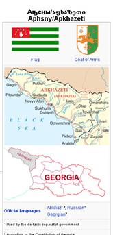
In the 9th-6th centuries BC,
the territory of modern Abkhazia was a part of the ancient
The Roman Empire conquered Egrisi in the 1st century
AD and ruled it until the 4th century, following which it regained a measure of
independence, but remained within the Byzantine Empire's sphere of influence. Though the
exact time when the population of Abkhazia was converted to Christianity is not determined, there is known
that the Metropolitan of Pitius participated in the First Oecumenical Council
in 325 in Nicea. Abkhazia was made an autonomous principality of the Byzantine
Empire in the 7th century — a status it retained until the 9th century, when it
was united with the province of Imereti and became known as the Abkhazian Kingdom. In 9-10th centuries the kings of
Abkhazs were trying to unify all the Georgian provinces and in 1001 King Bagrat III Bagrationi of Abkhazia became the
first king of the unified
In the 16th century, after
the break-up of the united
Genetics
A recent study of the
people of Indian Punjab, where about 40% or more of the population are Jats, suggest that the Jats are similar
to other populations of the Indus Valley.The study involved a genealogical DNA
test which examined single nucleotide polymorphisms (mutations in a single DNA
"letter") on the Y chromosome (which occurs only in males). (See
Human Y-chromosome DNA haplogroups for a listing and explanation.)
Jats seem to share many
common haplotypes with German, Slavic, Baltic, Iranian and Central Asian
groups.Unusually, Jat groups share only two haplotypes, one of which is also
shared with the population of present-day Turkey, and have few matches with
neighbouring Pakistani populations. This haplotype shared between the two Jat
groups may be part of the Indo-Aryan (or Indo-European) genetic contribution to
these populations, where as the haplotypes shared with other Eurasian
populations may be due to the contribution of Indo-European Scythians (Saka,
Massagetae) or White Huns. (These groups may of course all be branches of a
larger ethnic complex.)
As for mitochondrial DNA
(mtDNA), Jats contain haplogroups typical of North India, Pakistan, and West
Asia. This suggests that, at least for mtDNA, there is very little connection
with Central Asian or northwest European populations, even though Jats share
many male Y-SNP markers with these populations. Hence this suggests that there
has been male migration in or out of the Jat population in historical times.
Alternatively, the formation of the Jat population may have occurred in West
Asia or North India.
700s BC
From Wikipedia,
the free encyclopedia
(Redirected
from 700 BC)
Jump to: navigation, search
Centuries: 9th century BC - 8th century BC - 7th century BC
Decades: 750s BC 740s BC 730s BC 720s BC 710s BC - 700s BC - 690s BC 680s BC 670s BC 660s BC 650s BC
Events and trends
- 706 BC - Spartan immigrants found Taras (Tarentum, the modern Taranto) colony in southern Italy.
- 705 BC - Sennacherib succeeds his brother Shalmaneser V as king of Assyria.
- 704 BC - Sennacherib moves the capital of Assyira to Nineveh.
- 701 BC - King Hezekiah of Judah, backed by Egypt, revolts against king Sennacherib of Assyria. Sennacherib sacks many Palestinian cities, but fails in his
attempt to take Jerusalem.
- 700 BC - The Scythians start settling in Cimmerian areas, slowly replacing the
previous inhabitants.
- 700 BC - End of the Villanovan
culture in northern Italy and rise of the Etruscan civilization.
- 700 BC – The Upanishads, a sacred text of Hinduism, are written around this time.
]
Connection
between Poles and Vandals
From Wikipedia,
the free encyclopedia
In
the Middle
Ages and later
there persisted a common false belief that the Vandals were ancestors of Poles or Slavic peoples. That belief originated probably
because of two facts: first, confusion of the Venedes with Vandals and second, because both Venedes and Vandals in ancient times lived in areas
later settled by Poles. In 796 in the Annales Alamanici one can find
an excerpt saying Pipinus ... perrexit in regionem Wandalorum, et ipsi Wandali venerunt obvium ("Pippen went to
regions of Vandals and the Vandals came to meet him"). In Annales
Sangallenses the same raid (however put in 795 is summarised in one short message Wandali
conquisiti sunt ("Vandals were destroyed")). This means that
early medieval writers gave the name of Vandals to Avars.
Very soon after that in
chronicles the name "Vandal" started to
mean "Slavs" (eg. in the same Annales Alamanici about a
raid of Charlemagne in the country of the Polabian Slavs: perrexit in regionem Wandalorum).
In 1056 Annales Augustani mentioned defeat of Germans with Slavic Lucics (?) as exercitus Saxonum a
Wandalis trucidatur ("an army of Saxons is destroyed by
Vandals"). In the chronicle of Adam of Bremen there is a longer sentence:
Sclavania igitur, amplissima Germaniae
provintia, a Winulis incolitur, qui olim dicti sum Wandali; decies maior esse
fertur nostra Saxonia, presertim si Boemiam et eos, qui trans Oddaram sunt,
Polanos, quaia nec habitu nec lingua discrepant, in partem adiecreris Sclavaniae
that is: "Slavania (Slavic lands),
the biggest from Germanic countries, is inhabited by Winnils, who were formerly called Vandals. It is supposed to be
bigger than our
In 983-993 Gerhard of
Augsburg in Miracula Sancti Oudalrici (about saint Udalric) called Mieszko I dux
Wandalorum, Misico nomine.
Probably the first man who
directly mentioned supposedly Vandalic roots
of Poland was the Polish chronicler Wincenty Kadlubek in the 12th century, who wrote that Poles were once
called Vandals, because they live next to the river Vandalus (Vistula), and that
river received its name from the mythical queen Vanda who committed suicide by drowning
in it. A similar story was told by the author of Wielkopolska chronicle
from the 14th
century, and then
Dzierzwa from Krakow in the 14th century, who tried to give Slavic etymology
to all known Vandalic names, like deriving Vanda from węda,
that is fishing-rod.
In 12th century also Gerwazy from Tilbury, English
writer in Otia imperialia wrote that citizens of
Retrieved
from "http://en.wikipedia.org/wiki/700s_BC"
Sarmatians
From Wikipedia,
the free encyclopedia
Jump to: navigation, search

![]()

![]()
"
For the Semitic people, see Samaritan
The Sarmatians, Sarmatae
or Sauromatae were a multi-ethnic confederacy mentioned by classical
authors from Herodotus onward. Their major element in the south was undoubtedly
Iranian, and perhaps in prehistory there
was a founding Sarmatian tribe, or even two tribes: Sarmatians and Sauromatians
(though this does seem unlikely, and pedantic in the
extreme).
In history, however, many
tribes were under the name, which was Sarmatian to some, and Sauromatian to
others. Some authors say that they were the same. At their greatest reported
extent these tribes ranged from the Vistula river to the mouth of the Danube and eastward to the Volga, and from the mysterious domain of the Hyperboreans in the north southward to the
shores of the Black and Caspian seas, including the region between them as far
as the Caucasus
mountains.
The full array of peoples
who went under the aegis of "Sarmatians" must have spoken many
languages, but it is perhaps no coincidence that the boundary between the
so-called Centum-Satem
isogloss in the Indo-European
languages
apparently split at the European border of the Sarmatians. The Sarmatians
flourished from an era before the earliest European historical sources and
endured until the arrival of the Huns in the 4th century AD. That event shattered
whatever political unity they still had, causing their constituent peoples to
go their own ways. The Sarmatians who avoided Roman subordination eventually
were wiped out or conquered by the Huns, and the Sarmatians are credited with turning
the former lush land in their domain into a barren desert of infertile land.
Svaneti
From Wikipedia,
the free encyclopedia
(Redirected
from Svans)
Jump to: navigation, search
Svaneti (სვანეთი. Also known as Svanetia or Svania
in Russian and Western languages) is a historic province in Georgia, in the northwestern part of the country.
It is inhabited by the Svans (სვანები in Georgian), an ethnographic group of the Georgian people.
Contents[hide] |
]
Geography

![]()
View of the
Surrounded by 3,000-5,000
meter peaks, Svaneti is the highest inhabited area in Europe. Four of the 10 highest peaks of the Caucasus are located in the region. The
highest mountain in
Situated on the southern
slopes of the central Greater
Caucasus, the
province extends over the upper valleys of the Rioni, Enguri and Tskhenistskali. Geographically and historically,
the province has been divided into two parts – Zemo Svaneti (i.e., Upper
Svaneti; the present day Mestia Raioni) and Kvemo Svaneti (i.e., Lower Svaneti; the
present day Lentekhi raioni) – centering on the valleys
of the upper reaches of the two rivers Enguri and Cxenis-c’q’ali, respectively.
They are distributed between the present-day regions of Samegrelo-Zemo
Svaneti and Racha-Lechkhumi and Kvemo Svaneti respectively. Historical Svaneti also included
the Kodori
Gorge in the
adjoining rebel province of Abkhazia, and part of the adjacent river valleys of Kuban and Baksan of Russia.
Landscape
The landscape of Svaneti is
dominated by mountains that are separated by deep gorges. Most of the region which
lies below 1,800 meters (5,904ft.) above sea level is covered by mixed and coniferous forests. The forest zone is made up
of tree species such as spruce, fir, beech, oak, and hornbeam. Other species that are less common but may
still be found in some areas include chestnut, birch, maple, pine and box. The zone which extends from 1,800 meters to
roughly about 3,000 meters (5,904-9,840ft.) above sea level consists of alpine
meadows and grasslands. Eternal snows and glaciers take over in areas that are
over 3,000 meters above sea level. Svaneti is notable for its glaciers and
picturusque summits. Svaneti's signature peak is probably
Climate
The climate of Svaneti is
humid and is influenced by the air masses coming in from the Black Sea throughout the year. Average
temperatures and precipitation vary considerably with elevation. Annual
precipitation ranges between 1000-3200mm (39-126 inches). The highest amount of
precipitation falls on the Greater Caucasus Mountains. The region is
characterized by very heavy snowfall in the winter and avalanches are a frequent occurrence. Snow
cover may reach 5 meters (16.4 feet) in some areas. In general, the lowest
regions of Svaneti (800-1200 meters/2624-3936 feet above sea level) are
characterized by long, warm summers and relatively cold and snowy winters.
Middle altitudes (1200-1800 meters above sea level) experience relatively warm
summers and cold winters. Areas above 2000 meters above sea level lie within a zone that experiences short, cool summers (less
than 3 months) and long and cold winters. Large parts of Svaneti lie above 3000
meters (9840 feet) above sea level, a zone which does not have a real summer.
Due to Svaneti's close proximity to the Black Sea, the region is spared from the
extremely cold winter temperatures that are characteristic of high mountains.
History

![]()
Medieval towers in Mestia,
The Svans
are usually identified with the Soanes mentioned by Strabo, who placed them more or less in the area still
occupied by the modern-day Svans. The province had been a dependency of Colchis, and of its successor kingdom of Lazika (Egrisi) until AD 552, when the Suanians took advantage of the Lazic War, repudiated this connexion and went
over to the Persians. The Byzantines wanted the region, for if they secured its
passes, they could prevent Persian raids on the border areas of Lazica. With
the end of the war (562), Suaneti again became part of
Lazica. Then, the province joined Abkhazia to form a unified monarchy which was
incorporated into the
The marauding Mongols never reached here and for a time Svaneti
became a cultural safe house. Following the final disintegration of the
Part of the Russian governance of Kutais, Svaneti was divided into two districts (raions) – Mestia and Lentekhi under the Soviet rule. Scattered guerilla actions against the Bolsheviks occurred in the province in 1922-1924.
In 1987 avalanches destroyed several homes and killed
seventy, mostly school children. Collapse of the Soviet Union, and subsequent civil
war created severe
socioeconomic problems in the region. While the Svan population resisted the
unpleasant conditions of the high mountain environment they lived in for
centuries, the increasing economic difficulties of the last two decades and
frequent natural disasters – floods and landslides as of April 2005 ([1]) have brought about a strong tendency towards
migration. The province became a safe haven for criminals threatening local
residents and tourists. Large-scale anti-criminal operations carried out by the
Georgian Special Forces as of March 2004 ([2]) resulted in significant improvement of the
situation.
[
Population
The Svans, indigenous
population of the area, are ethnographic group of the Georgian people. Until the 1930s Mingrelians and Svans had their own census
grouping, but were classified under the broader category of Georgian
thereafter. They are Georgian Orthodox Christians, and were Christianized in the
4th-6th centuries. However, some remnants of old paganism have been maintained.
Saint George (known as Jgëræg to the locals), a patron saint of Georgia, is the most respected saint. The
Svans have retained many of their old traditions, including blood revenge.
Their families are small, and the husband is the head of his family. The Svan
really respect the older women in families.
Typically bilingual, they
use both Georgian and their own, unwritten Svan language, which together with the Georgian, Megrelian, and Laz languages constitute the Kartvelian, or
South Caucasian language family. The Svan language is being largely replaced
by the Georgian proper.
Culture and tourism
Svaneti is known for their
architectural treasures and picturesque landscapes. The Botany of Svanetia is
legendary among travelers. The famous Svanetian towers erected mainly in the
9th-12th centuries, make the region’s villages more
attractive. In the province are dozens of Georgian Orthodox churches and
various fortified buildings. Architectural monuments of
Svan culture survives most
wonderfully in its songs and dances. Svaneti boasts the most complex form of
Georgian polyphonic singing, traditional to Georgian vocal music.
Sventevith,
Svetovid, Suvid, Svantevit, Svantovit, Svantovít, Swantovít, Sventovit,
Zvantevith, Świętowit, Sutvid, Vid. and,
incorrectly, Światowit is the Polabian deity of war, fertility and abundance.
Sometimes referred to as
Beli (or Byali) Vid, Beli = white, bright, shining (as in the folklore
poem Vojevao Beli Vide/Tri god'ne s kleti Turci/A cet'ri s crni Ugri...
- Beli Vid waged war/Three years with the damn Turks/And four with the black
Hungarians).
Associated
with war and divination. Described as a four-headed
god with two heads looking front and two back. A statue portraying the
god shows him with four heads, each one looking in a separate direction, a
symbolical representation of the four diections of the compass, and also
perhaps the four seasons of the year. Boris Rybakov argued for identification of the
faces with the gods Perun, Svarog, Lada and Mokosh (c.f. Zbruch idol). Joined together, they see all
four sides of the world. This gave rise to a false etymology of the name of the
god as "worldseer" (svet = "world", vid =
"sight"; Svetovid = "worldseer"). However, the forms
Sventevith and Zvantewith show that the name derives from the
word svętъ, meaning "saint, holy". The second stem is sometimes
reconstructed as vit = "lord, ruler, winner". The name
recorded in chronicles of contemporary Christian monks is Svantevit, which, if
we assume it was properly transcribed, could be an adjective meaning aprox.
"Dawning One" (svantev,svitanje
= "dawning, raising of the Sun in the morning" + it, adjective
suffix)).
He always carries his sword
(sometimes bow) in one hand, and in the other a drinking horn. Svetovid had a
white horse which was kept in his temple and taken care of by priests. It was
believed Svantevit rode this horse in battle. The horse was used for
divination. Victory in battle, merchant travels and a succsessful harvest all
depended on Svantevit.
The main temple of
Świętowit was located in Arkona on Rugia
The temple was also the
seat of an oracle in which the chief priest predicted the future
of his tribe by observing the behaviour of a white horse identified with
Świętowit and casting dice. The temple also contained the treasury of the
tribe and was defended by a group of 300 mounted warriors which formed the core
of the tribal armed forces.
Some interpretations claim
that Svetovit was in fact another name for Radegast or Belobog, while another states
that Svetovit was a fake god, a Wendish construction based on the name St. Vitus. According to a questionable
interpretation, Swietowit was a Rugian counterpart of the all-Slavic Perun common in Slavic mythology.
In


http://home.swipnet.se/~w-93783/Istaby/istaby.html

http://www.historiska.se/learning/vikingar/aristokratin.html
Luxury
and abundances.
Pampiga parties in wards on big goods. Beautiful ships, side uniting clothing
and weapons hammered of mästersmeder. As war gentlemen surrounded the itself with small armies of faithful men. The traveled runstenar, dug down silver wealths and built castles of
wood. Political alliances with other aristokratiska families
were created and was broken. Överklassens goods with your giant house
low placed on heights that were visible wide about in Skandinaviens agriculture
districts. Men and women that “the
goods gentleman from Vendel” in
Uppland and “härskarinnan from Köpingsvik” on Öland dominated your time.

BLEKINGE
Vendel era
From Wikipedia,
the free encyclopedia
The Vendel era
(550-793) is the name given to a Swedish part of the Germanic Iron Age (or, more generally, the Age of Migrations).
The migrations and the
upheaval in
In Scandinavia, the Germanic clan society was still very much alive. In Sweden, Old Uppsala was the centre of both religious
and political life. It had both a well-known sacred grove, a royal estate (see Uppsala öd) and great Royal Mounds.
There were lively contacts
with
The finds in Vendel
and Valsgärde show that Uppland was an important and powerful area consistent
with the sagas' account of a Swedish kingdom. Some of the riches were probably
acquired through the control of mining districts and the production of iron.
The rulers had troops of mounted elite warriors with costly armour. Graves of
mounted warriors have been found with stirrups and saddle ornaments of birds of
prey in gilded bronze with incrusted garnets.
These mounted elite
warriors reverberate in the work of the 6th century Goth scholar Jordanes who wrote that the Swedes had the best horses
beside the Thuringians. They also echo much later in the Norse sagas, where king Adils is always described as fighting on horseback
(both against Áli and Hrólf Kraki). Snorri Sturluson wrote that Adils had the best
horses of his days.
Games were popular as is
shown in finds of tafl games, including pawns and dice.
This is the time when
Swedish pillaging expeditions start to explore the waterways of what was to
become Russia.

Vendel () is a
parish in the Swedish province of Uppland.
It is the site of an ancient royal estate (part of a network of royal estates that
have been the property of the Swedish kings since the Iron
Age, called Uppsala
öd).
The
site has many graves from the 5th, 6th
and 7th
centuries. It also shows a large mound which local tradition calls Ottarshögen
(the mound of Ohthere
of the epic Beowulf).
An excavation in 1917
revealed the remains of a powerful man who was buried in the beginning of the 6th
century, the time of Ohthere.
Vendel has given its name to a period in the Scandinavian
Iron Age, and it has often been suggested that the Germanic Vandals, or at least their kings, were
connected to the site. A
grave of Sutton
Hoo (King Raedwald of East Anglia
(?)) revealed that the man it contained wore virtually the same armour as what
was found in the close burial site of Valsgärde.
The
location has lent its name to a period in Swedish archaeology: the Vendel
Age.
Retrieved
from "http://en.wikipedia.org/wiki/Vendel
The time between the Migration Period and the Viking
Age, c AD 550-800, is known as the Vendel Period after a cemetery beside Vendel
church, near one of the tributaries of the Fyris river
in northern Uppland. Rulers of one of the most powerful dynasties in Uppland
were buried there during both the Vendel Period and the Viking Age.
Your continued donations keep Wikipedia
running!
Blekinge
County
From Wikipedia, the free encyclopedia
Jump
to: navigation,
search
Blekinge
County, or Blekinge
län is a County or län in the
south of Sweden.
It borders to the Counties of Skåne,
Kronoberg,
Kalmar
and to the Baltic
Sea.
|
Blekinge län |
|
||
|
|
|
|
|
|
|
|||
|
|
|||
|
|
|||
|
Created |
|
||
|
Area |
2,941 km², 0.7% of |
|
|
|
Population |
150,625 inh., 51.2 inh/km² |
|
|
|
See this ranked list |
|
||


|
|
Province
For
History, Geography and Culture see: Blechingia
Blechingia,
the historical province Blekinge, has virtually the same boundaries as
the current administrative entity, Blekinge County.
[edit]
Administration
Blekinge
County was a part of Kalmar County between 1680 and 1683, due to the
foundation of the naval base at Karlskrona.
The
main aim of the County Administrative Board
is to fulfil the goals set in national politics by the Parliament and the Government, to coordinate the interests and
promote the development of the county, to establish regional goals and
safeguard the due process of law in the handling of each case. The County
Administrative Board is nominally a Government Agency headed by a
Governor. See List of Blekinge Governors.
Politics
Main
article: Blekinge County
Council
Blekinge
County Council, or Landstinget Blekinge, is a municipal entity that is
independent of, but coterminous with, the County Administrative Board. Its main
responsibilities lie in health care and public transportation issues for the
county.
[edit]
Municipalities

- Olofström Municipality
- Sölvesborg Municipality
- Karlshamn Municipality
- Ronneby Municipality
- Karlskrona Municipality
Heraldry
Main
article: Heraldry of Blekinge
The
County of Blekinge inherited its coat of arms from the province of Blechingia.
When it is shown with a royal crown it represents the County Administrative
Board.
Miscellaneous
topics
External
links
R1a
Haplotype#22 with two points of difference,but my parents came from the region
of Krakow./It means it is a recent migration.The chain is not broken, because
we consider 4x16 =64 generations and there is place enough to outsiders.

http://tade.wanclik.free.fr/Wang.htm
|
|
|
|
|
|
|
vendel in
the century IV reconstitued in Blekinge |
wanclik
in the century XXI |
wanclik
in the century XX |
|
|
|
28 12 instead of 13 |
tw |
tw |
|
|


Origins
The Vandals were first
identified with Przeworsk
culture in the 19th century [citation needed]. Controversy surrounds potential connections
between the Vandals and another possibly Germanic tribe, the Lugii (Lygier, Lugier or Lygians). Some academics
believe that either Lugii was an earlier name of the Vandals, or the Vandals
were part of the Lugian federation.
![]()
|
The Przeworsk culture (green) in the first
half of the 3rd century. Przeworsk culture
From
Wikipedia, the free encyclopedia
The green area is the
Przeworsk culture in the first half of the 3rd century. The red area is the extent of
the Wielbark
culture, the
yellow area is a Baltic culture (Yotvingian?), and the pink area is the
Debczyn Culture. The dark blue area is the Roman Empire The Przeworsk culture
is part of an Iron Age archaeological complex that dates
from the 2nd
century BC to the
4th century. It was located in what is now
central and southern Poland and parts of eastern Slovakia and Carpathian
Ruthenia ranging
between the Odra and the middle and upper Vistula Rivers into the headwaters of the Dnestr and Tisza Rivers. It takes its name from the village
near the town Przeworsk where the first artefacts were
found. The immediately preceding
and more widespread Lusatian culture occupied this same area. To the
east, in what is now northern At its northeastern edge,
the Goths developed the Wielbark culture along the lower and middle Roman-era writers report
this area as being occupied by Lugians. A substantial effort has been expended in
the past to characterize this as an early Slavic-speaking community. Modern thinking,
however, leans towards assigning the culture to an East-Germanic-speaking people who likely evolved into the Vandals, though doubtless there was
overlapping interpenetration with Slavic-speakers. The early Burgundians occupied portions of the area
towards the end of this cultural period. Certainly, however, the undisputedly
Slavic-speaking Venedi were later found exactly here. [edit] The
map shows the extent of the Wielbark culture (Goths)
in red,
Wielbark Culture
Areas in the first half
of the 3rd
century: Wielbark
culture (red) , Przeworsk
culture (green),
a Baltic culture (Aesti?, yellow), Dębczyn Culture
(pink) and the Roman
Empire (dark
blue) Wielbark Culture (German: Willenberg Kultur, Polish: Kultura wielbarska) was an archaeological culture
identified with the Goths which appeared during the first
half of the 1st
century AD. It
replaced the local Oksywie Culture (Oxhöft Kultur), a culture which
was part of the Przeworsk
culture. After a cemetery of over
3000 tombs was discovered in the time of the German Empire, the culture it was attributed to
was named Willenberg Kultur in German after the nearest village,
called Willenberg at the time (today Wielbark).
It is located near Malbork (Marienburg), about 40km south of
the The report of the
original excavation was rediscovered in 2004. A project of the Humboldt
University in Berlin intends to restore and analyze it, in
cooperation with Polish partners and funded by Dronning Margrethe og Prins
Henriks Fond. .. |
|

|
|
|
|
Baltic culture (Aesti?)
in yellow, Aesti
From
Wikipedia, the free encyclopedia
The yellow area is a
Baltic culture (the Aesti?); the red area is the extent of the Wielbark culture in the first half of the 3rd century. The green area is the Przeworsk
culture, and the
pink area is the Debczyn
Culture. The dark
blue area is the Roman
Empire the Aesti (or Aestii)
were a people described by the Roman historian Tacitus in his book Germania (ca. 98 CE). According to his account, the Aesti
spoke a language related to that spoken in Britain; they worshipped a deity known as
the 'mother of the gods', as well as the wild boar commonly found in the
region; for weapons they used wooden clubs and occasionally iron implements;
they were also the only people to gather and trade amber. Most scholars identify
the Aesti as ancient inhabitants of Prussia, speakers of a Baltic language closely related to modern Latvian and Lithuanian. This identification is
based primarily on their association with amber, a popular luxury item during
the life of Tacitus, with known sources at the southeastern coast of the Baltic Sea. The Baltic amber trade, which appears to have extended
to the Mediterranean
Sea, has been
traced by archaeologists back to the Nordic
Bronze Age; its
major center was located in the region of Sambia. Some historians think
that the term Aesti may refer to all of the peoples living by the
eastern coast of the Whatever the case, it
seems that the word was eventually applied specifically to Estonians and is the origin of the modern
national name of Estonia, called Eistland in
ancient Scandinavian Sagas and Estia, Hestia and |
|
|
|
|
The Roman Empire is purple.
Roman Empire
From Wikipedia,
the free encyclopedia
|
Imperium Romanum |
|
The |
|
National Motto: Symbolic animal: |

The
"
The precise date at which
the Roman Republic changed into the Roman Empire is disputed, with the dates of
Julius Caesar's appointment as perpetual dictator (44 BC), the battle of Actium, September 2, 31 BC, and the date in which the Roman Senate
granted Octavian the title Augustus, January 16, 27 BC, all being advanced as candidates. To confuse
matters even further, Octavian officially proclaimed that he had saved the
The end of the
From the time of Augustus
to the Fall of the Western Empire,
Similarities of names have
suggested homelands for the Vandals in Norway (Hallingdal), Sweden (Vendel), or Denmark (Vendsyssel). The Vandals are assumed to have
crossed the Baltic into what is today
Main article: connection between Poles and Vandals
In medieval times, there was a popular belief that
Vandals were ancestors of Poles. That belief originated probably because of two
facts: first, confusion of the Venedes with Vandals and secondly, because both
Venedes and Vandals in ancient times lived in areas later settled by Poles. In 796, in the Annales Alamanici, one can find an excerpt saying,
"Pipinus ... perrexit in regionem Wandalorum,
et ipsi Wandali venerunt obvium"
("Pepin went to the region of the Vandals, which Vandals
did come out to oppose him"). In Annales
Sangallenses,
the same raid (however, put in 795) is summarised in one short
message, "Wandali conquisiti
sunt" ("The Vandals were
destroyed"). This means that early medieval writers gave the name of Vandals to Avars.
[edit]
History
Centum-Satem isogloss
From Wikipedia,
the free encyclopedia
Jump to: navigation, search
Centum redirects here.
See Centum
(disambiguation) for other uses of the term.

![]()
Diachronic map showing the
Centum (blue) and Satem (red) areals. The supposed area of origin of
Satemization is shown in darker red (Sintashta/Abashevo/Srubna cultures).

![]()
Hypothetical
situation around 2000 BC. The Corded Ware horizon is underlaid in yellow.
The Centum-Satem
division is an isogloss of the Indo-European
language family,
explaining the evolution of the three dorsal consonant rows reconstructed for Proto-Indo-European, *kʷ (labiovelars), *k (velars), and *ḱ; (palatovelars). The terms come
from the words for the number "one hundred" in representative
languages of each group (Latin centum and Avestan satəm).
The Satem languages
include Indo-Iranian, Balto-Slavic (Baltic and Slavic), Albanian, Armenian and perhaps also a number of barely documented
extinct languages, such as Thracian and Dacian. Although Albanian is treated as a Satem language, there may be some evidence that the plain
velars and the labiovelars were not completely merged in Proto-Albanian.
The Centum group is
often thought of as being identical to "non-Satem", i.e. as including
all remaining dialects. More specifically, in the sense of Brugmann's
"languages with labialization", the Centum group includes Italic, Celtic, Germanic, Greek, and possibly a number of minor and little
known extinct groups (such as Venetic and the ancient Macedonian language and probably the Illyrian
languages).
Tocharian, on the other hand, combined all
rows into a single velar row, and is therefore typically considered
"Centum", although the relative chronology of the change is unknown.
Likewise, the proto-language of the Anatolian
languages
apparently did not undergo either the Satem or the Centum
sound change. The velar rows remain separate in Luwian, while Hittite may secondarily have undergone a Centum change, but the exact phonology is unclear.
Proto-Indo-European
dorsals
The Centum-Satem isogloss
explains the evolution of the three dorsal rows reconstructed for PIE, *kʷ, *gʷ, *gʷʰ (labiovelars), *k,
*g, *gʰ (velars), and *ḱ, *ǵ, *ǵʰ; (palatovelars) in the daughter
languages. A division into a Centum and a Satem group
does only make sense with a view to the parent language with the full inventory
of dorsals. Later sound changes within a specific branch of Indo-European that
are similar to one of the changes, such as the palatalization of Latin k to s in some Romance languages or the merger of *kʷ with *k in the Goidelic
languages, have no
effect on the grouping.
August
Schleicher in
his 1871 Compendium assumes only a single velar row, k, g, gh.
Karl
Brugmann in his 1886 Grundriss accepts only
two rows, denoting them q, g, gh "velar
explosives" vs. k̑, g̑ and g̑h
"palatal explosives". Brugmann terms the Centum
languages "languages with labialization" or "u̯-languages" and the Satem languages
"languages without labialization", and he opines that
For words and groups of words, which do not
appear in any language with labialized velar-sound, [the "pure velars"] it must for
the present be left undecided whether they ever had the u̯-afterclap.
(trans. J. Wright)
By the 1897 edition of his work, Brugmann changed his
mind, accepting the centum vs. satem terminology introduced by
von Badke in 1890. Accordingly, he denoted the labiovelars as qu̯, qu̯h,
gu̯, gu̯h
(also introducing voiceless aspirates).
The presence of three
dorsal rows in the proto-language is still not universally accepted. The
reconstructed "middle" row may also be an artifact of loaning between
early daughter languages during the process of Satemization. For
instance, Oswald
Szemerényi (e.g.,
in his 1995 Introduction), while recognizing the usefulness of the distinction *kʷ, *k,
*ḱ as symbolizing sound-correspondences
does argue that the support for three phonologically distinct rows in PIE is
insufficient and prefers a twofold notation of *kʷ, *k. Other
scholars who assume two dorsal rows in PIE include Kuryłowicz (1935), Meillet (1937), Lehmann (1952), and Woodhouse (1998).
[
Satem
The Satem languages
show the characteristic change of the so-called Proto-Indo-European palato-velars (*ḱ, *ǵ, *ǵʰ) into affricate and fricative consonants articulated in the front of the
mouth. For example, *ḱ
became Sanskrit ś [ʃ], Avestan, Russian and Armenian s, Lithuanian š [ʃ], and Albanian th [θ]. At the same time, the
protolanguage velars (*k, *g, *gʰ) and labio-velars (*kʷ, *gʷ, *gʷʰ) merged in the Satem group, the latter losing
their accompanying lip-rounding.
The Satem shift is
conveniently illustrated with the word for '100', Proto-Indo-European *ḱm̥tóm, which became e.g. Avestan satəm (hence the
name of the group), Farsi sad, Lithuanian šimtas, Russian sto, etc., as contrasted with Latin centum (pron.
[kentum]), English hund(red)- (with /h/ from earlier *k, see Grimm's law), Greek (he)katon, Welsh cant, etc. (The Albanian word qi
Lithuanians
From Wikipedia,
the free encyclopedia
Lithuanians are the ethnic group native to Lithuania, where they number a little over 3 million [7]. Another million or more make up the
Lithuanian diaspora, largely found in countries such as
the United
States, Brazil, Canada and Russia. Their native language is Lithuanian, one of only two surving members of
the Baltic
language family.
According to the census conducted in 2001, 83.45% of the population of
Lithuania proper identified themselves as Lithuanians, 6.74% as Poles, 6.31% as Russians, 1.23% as Belarusians, 2.27% as member of other ethnic
groups. Most Lithuanians belong to the Roman
Catholic Church.
The Lietuvininkai, a part of the Lithuanian nation
near the former German-Lithuanian border, were mostly Lutherans.
[]
History
The territory of the Balts,
including modern Lithuania, was once inhabited by several Baltic tribal
entities (Sudovians, Lamatians, Curonians, Selonians, Samogitians, Nadruvians and others), attested by ancient
sources and dating from prehistoric times. Over the centuries, and especially
under the Grand Duchy of Lithuania, some of these tribes consolidated into the Lithuanian nation, mainly
as a defense against the marauding Teutonic Order and Muscovite Russians.
During the process they converted suddenly to Christianity. Lithuanians were the last
surviving non-nomadic European nation to abandon paganism.
Since the time of Grand
Duchy, Lithuanian territory has shrunk - once Lithuanians made up a majority of
population not only in what is now Lithuania, but also in northwestern Belarus, in large areas of the territory of modern Kaliningrad
Oblast of Russia, and in some parts of modern Latvia and Poland.
However, due to a late
medieval view that the Lithuanian language was unprestigious, a preference for
the Polish language in the territories of the Polish-Lithuanian commonwealth, as well as a preference for the German language in the territories of the former East Prussia (now Kaliningrad
Oblast of Russia), number of Lithuanian speakers shrank.
Subsequent imperial
Russian occupation
accelerated this process due to process of russification (ban on public
speaking and writing in Lithuanian (see, e.g., "Knygnešiai"), actions against Catholic church). It was believed by some at the time that the nation
as such would become extinct within a few generations.
At the end of the 19th century a Lithuanian cultural and
linguistic revival occurred. Some of Polish- and Belarusian-speaking
Lithuanians still affiliated themselves with the Lithuanian nation, although
others did not.
The Lithuanian nation as
such, remained primarily in
Ethnic composition of
Lithuania
Main Article: Demographics of Lithuania
Poles are concentrated in
the Vilnius
region, area
controlled by
Russians, even though their
number is very close to Poles, are much more evenly scattered and do not have a
strong political party. The most prominent community lives in Visaginas city municipality (52%). Most of them are scientists who moved from
In the past, ethnic composition
of
[
Cultural Subgroups
Beyond the various
religious and ethnic groups currently residing in Lithuania, Lithuanians are
usually divided into 5 groups: Samogitians, Sudovians, Aukštaitians, Dzūkians and Lietuvininks, the last of which is extinct. City
dwellers are usually considered just Lithuanians, especially ones from large
cities such as Vilnius or Kaunas.
The five groups are
determinated according to certain region-specific traditions, dialects,
historical divisions and such. There are also some stereotypes used in jokes
about these subgroups, e.g. that Sudovians are supposedly frugal while
Samogitians are stubborn.
Genetics
Lithuanians are among the tallest people in the world. Average height of males is 181.3 cm, females - 167.5 cm. Height acceleration was fast through the 20th century although now it has slowed down. In the end of 19th century height of males was 163.5 cm and height of females was 153.3 cm. [1]
Slavs
- Primer Page
- Origin of the term Slav
- Proto-Slavic language
- Origins and Slavic homeland debate
- Slavs in the historical period
- Religion and alphabet
- Ethno-cultural subdivisions
- Notes
- Gallery
- See also
- External links

![]()
Distribution of Slavic peoples
by language

![]()
Countries inhabited by
Slavic peoples
The Slavic peoples
are a linguistic and ethnic branch of Indo-European peoples, living mainly in Europe. Since emerging from their original homeland
(most commonly thought to be in Eastern Europe) in the early 6th century, they have inhabited most of eastern Central Europe,
Slavic peoples are traditionally divided along linguistic lines into West Slavic (including Czechs, Poles and Slovaks), East Slavic (including Belarussians, Russians, and Ukrainians), and South Slavic (including Bosniaks, Bulgarians, Croats, Macedonians, Montenegrins, Serbs and Slovenians). For a more comprehensive list, see Ethno-cultural subdivisions.
|
|
|
|

|
|
